The Howe Sound Crest Trail spans around 30km of jaw-dropping ridges and forest overlooking the body of water the stretches from Squamish to West Vancouver. It is one of the premier south western BC hiking experiences. At 30km it may not sound intimidating, but with over 1500m of elevation when moving south to north (and even more going the other way), countless boulders to crawl over, and a lack of water for much of the way, this trail is no simple walk-in-the-park. I attempted to tackle this trail as an overnight backpacking trip in the summer of 2018 with my father and it was definitely an adventure. The rest of this post provides some insight into what it was like to attempt the Howe Sound Crest Trail.
September 6th, 2018
7:30am (The Start)
We started in the morning with a sense of excitement. My Dad and I were dropped off by my mother just before 7:30am. As this trail is a point-to-point trail we were planning to be picked up the following afternoon at the other trailhead.
When we set out we had just over 12 hours until sunset – plenty of time to make it around 17.5km to our desired camping spot of Magnesia Meadows – or so we thought.
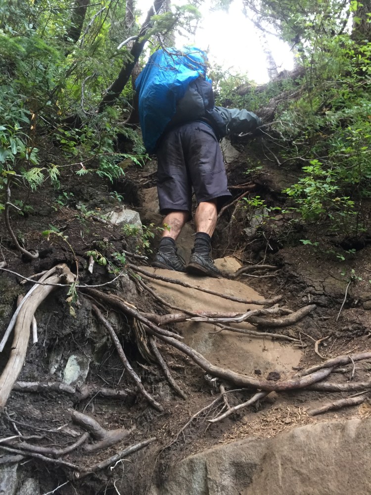
With maps in our hand and 30 pounds on our back we set out on the trail. The weather was much better than we had expected with a relatively warm late summer morning – a little too warm as we discovered later. The first part of the trail was a nice and easy walk through the ski resort and tame forest trails. It was a chill start to the day and we moved at a quick pace that made me confident that we would be moving efficiently throughout the day.
8:00am (The Map) ~2km
Half an hour in we have made it to our first landmark – a large signboard with a map of our journey. As we approached the board, I noticed a sign that read the following, “Pack 1 litre of water for every 1 hour of hiking when the temperature is above 20°C.” As we read that sign with a comfortable air temperature of 15°C we chuckled a little thinking that there was no way that we were going to need that much water – a few hours later when it was 26°C we were no longer laughing. After a quick break we continued quickly while the sun was still relatively low and the trail was empty.
9:15am (St. Marks Summit) ~ 6km
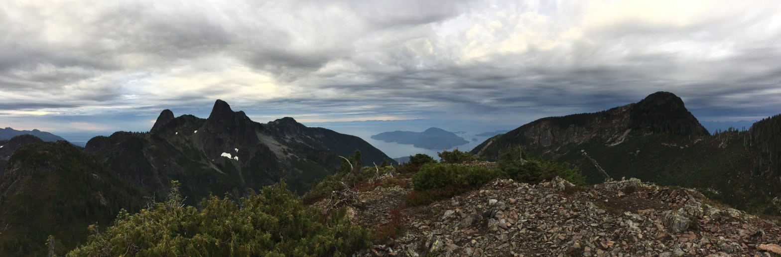
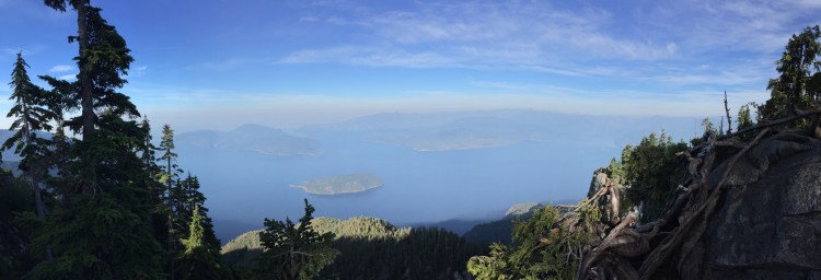
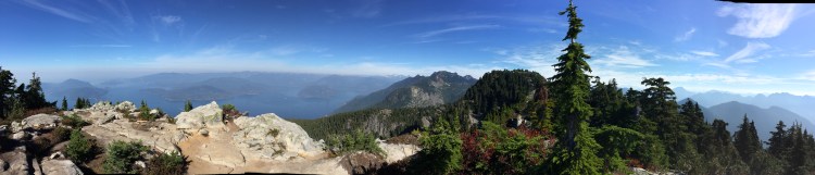
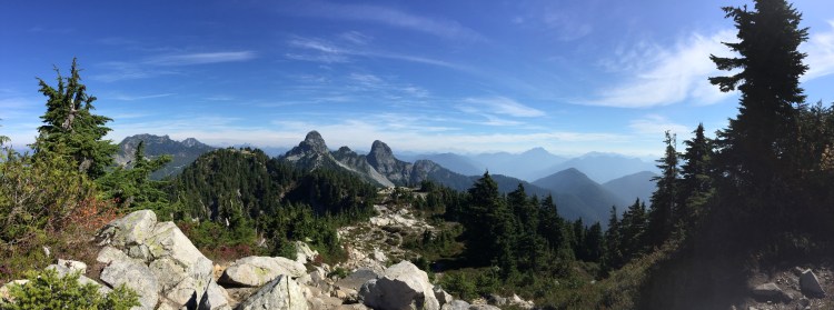
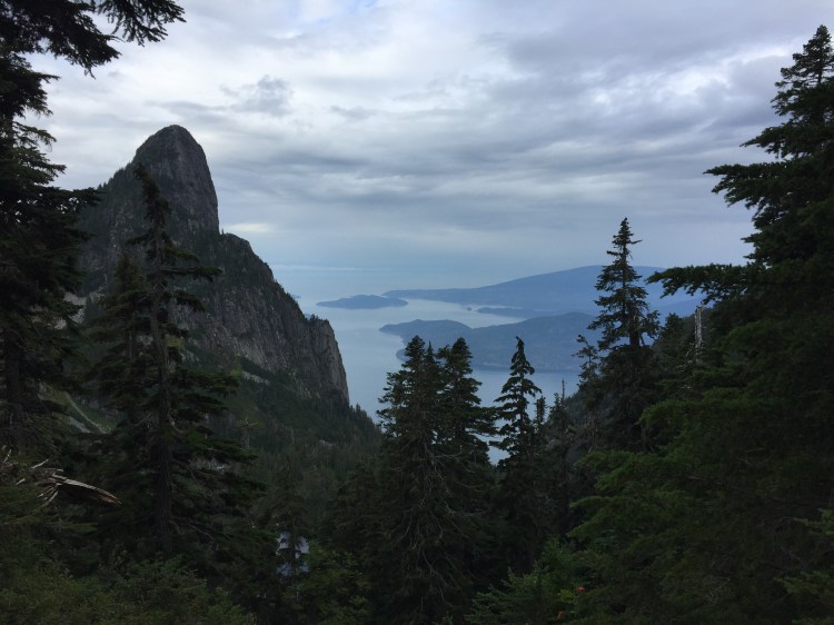
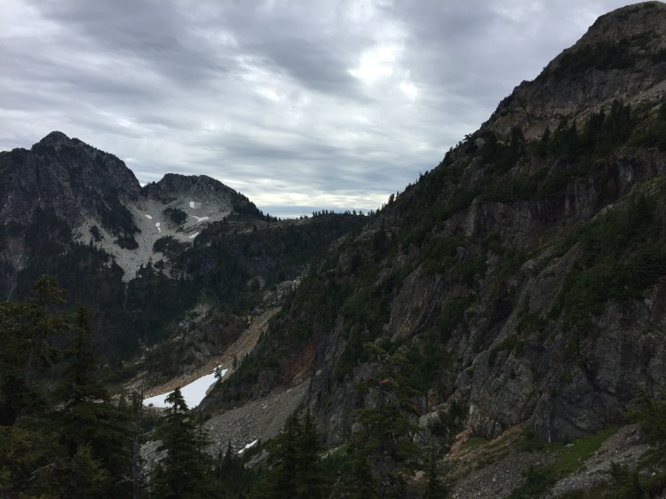
A little over an hour later we made it to St. Marks Summit. To the left of the trail was a steep drop that provided us with our first open view of Howe Sound below. With the sun now getting higher and the sky mostly clear, the temperature was also climbing to a warm, but still comfortable 18°C. After quickly taking in the view, we readied ourselves for the trail ahead. Neither of us had walked the trail from this point onwards, so we left St. Marks Summit with the excitement that comes with breaking new ground. The new portion of the trail started with a steep downhill and we instantly could feel the change in the trail that we had walked many times to the trail we had never walked.
9:45am (Unnecessary Mountain Climb) ~7km
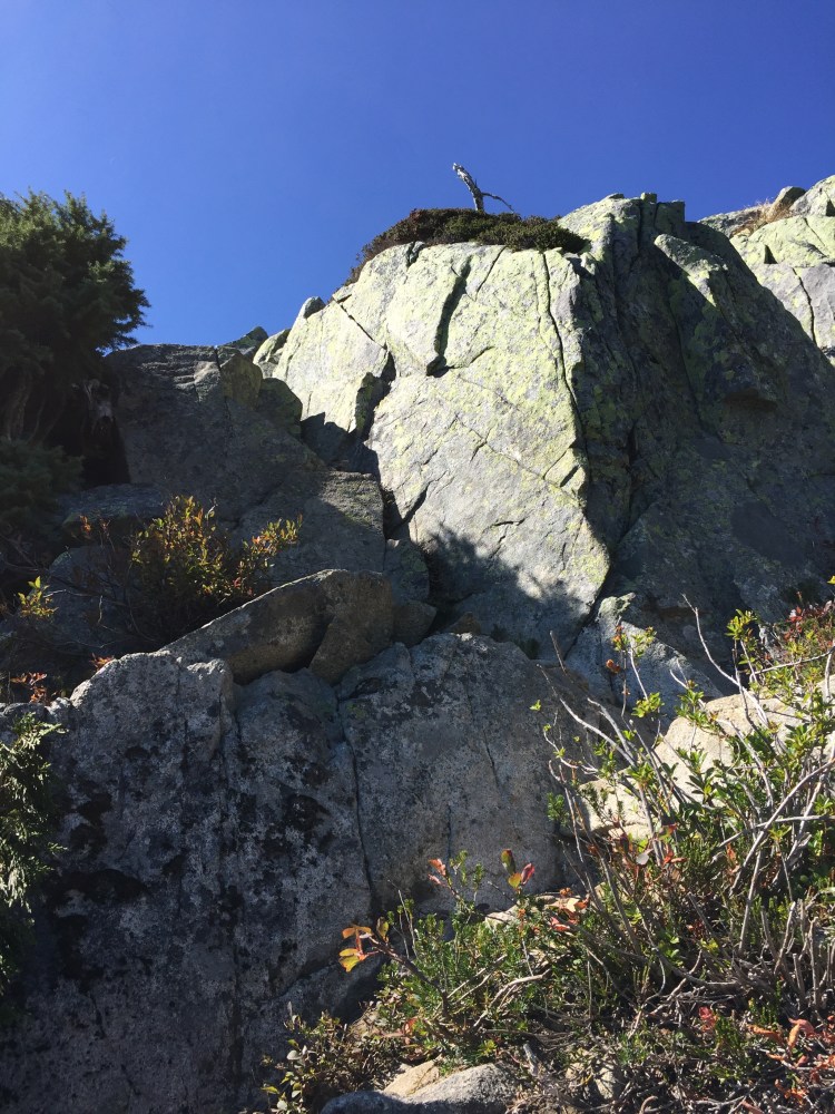
As the downhill ended, a climb immediately approached. Our speed started to reduce as we navigated our way around fallen trees and debris and our heart rates increased with the increasing grade of the trail. As we climbed up the path the climb felt fittingly unnecessary, which explained why the peak we were climbing to was named Unnecessary Mountain.
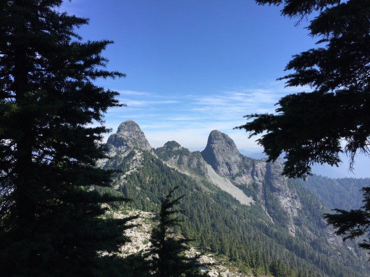
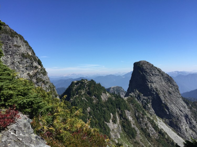
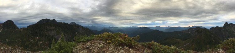
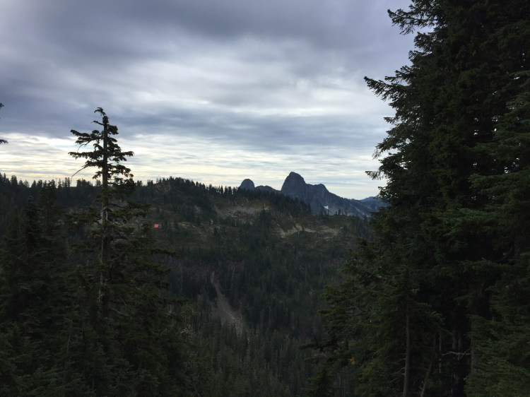
On the HSCT, once you reach the south summit of Unnecessary Mountain you really start to get a picture of what lies ahead. Beyond the first summit, views of the famous Lions, visible from many places around the Lower Mainland, begin to open up and the path is laid out before your feet. You finally get the feeling that you are walking the Howe Sound CREST Trail as the terrain slopes down on both sides of the trail and peaks lay off in the distance. This is where it starts to get real fun… and a whole lot harder.
11:09am (View of the Lions) ~9.5km
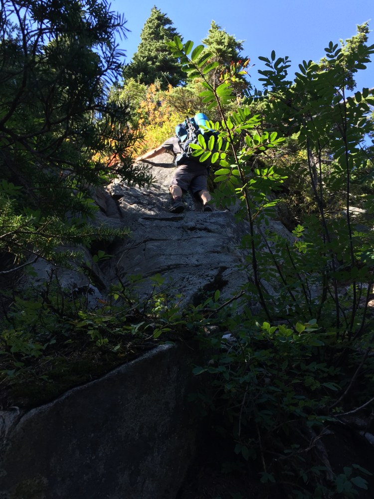
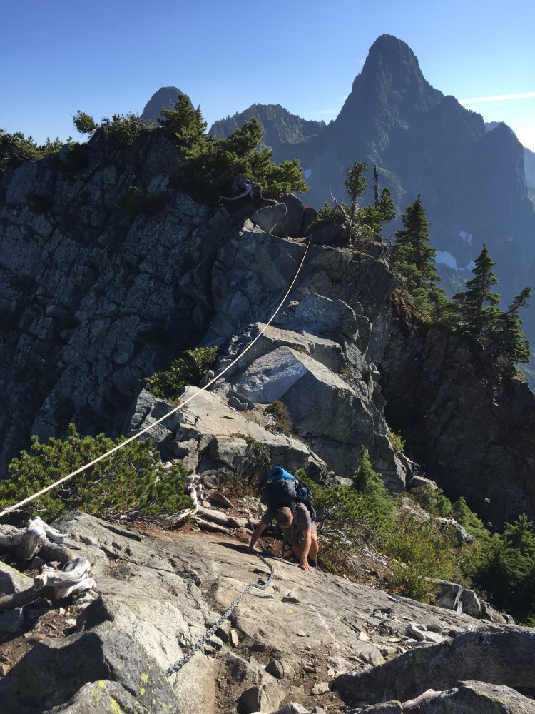
We took a quick break right after 11am to take in a view of the Lions in front of us and get ready for the trail ahead. Just beyond where we took our break was where things started to get interesting. As we made our way to the north summit of Unnecessary Mountain and beyond, we encountered some tight squeezes down steep, rocky slopes with some ropes to help. The large packs on our backs certainly didn’t help with the narrow gaps between the rocks. We continued along the ridge at a pace that was dropping alarmingly. The temperature was now hovering just over 22°C and we were beginning to feel it. My Dad was starting to lag behind and I was starting to slightly worry that we would not make it to our designed camping spot of Magnesia Meadows at this pace.
The ridge continued until we reached a spot that required a little scrambling in order to get to the major viewpoint for the Lions. I made it to the top feeling good and then turned around to see how my Dad was getting along – he did not look good. He was low and on all fours struggling to find a way up. I took off my pack and headed down to lend a hand. As I reached him, he turned to me and said, “I can’t do this.” In my head I just quickly dismissed this as the words of an overheated and very hungry hiker who wasn’t thinking clearly (it was 1:00pm and lunch was overdue after all), but he was definitely having a lot of trouble. With some assistance and coaxing I assured him he was okay and we both made it to the top together. We sat down and had some lunch.
1:11pm (Steps of the Lions) ~11.75km
1:32pm (Post-lunch Descent)
I hoped the food would give my Dad some more confidence. The view of the Lions at our lunch spot was amazing. The West Lion loomed close beside us as we ate. I was doing some quick calculations in my head to see how much farther we had to go to get to Magnesia Meadows and our home for the night, or at least the home we were hoping for. After looking at the maps I determined we only had around 5.5km until our destination, not too bad – or at least that’s what I thought. What I didn’t realize is that the rest of the trail to Magnesia Meadows was a roller coaster ride of climbs and descents with no water sources on the trail while the temperature was still rising. In reality we would move at a pace of 1 hour and 27 minutes PER KILOMETRE for the rest of the day.
We finished lunch, put on our packs and headed down from the viewpoint to where we would walk across the face of the West Lion and then make our way between the two massive rock humps.
1:55pm (Walk across the Lions) ~12km
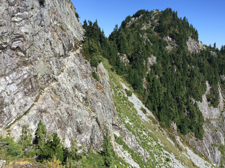
We arrived at the walk across the West Lion just before 2:00pm. At this point the trail cuts right through the steep side of the rock with one slip meaning a dangerous and potentially fatal fall. I was feeling ready to make the crossing, but my Dad was not feeling the same. I decided to take the lead and cross first. I made it across feeling good and looked back to see my Dad standing at the beginning with a look of fear in his eyes – he was not feeling good about this. I tried talking him down and encouraging him, but he was still terrified to make the crossing. I grabbed his pack to help him feel more comfortable and slowly, but surely we made it across together. Once we reached the far side of the Lion traverse, I could tell that my Dad was exhausted both physically and mentally, and I quickly realized that we were running out of water with a significant portion of our day still ahead of us. Our next official water source was not until Magnesia Meadows and with the temperature now reaching 24°C the sign at the beginning of the day that read “Pack 1 litre of water for every 1 hour of hiking when the temperature is above 20°C” was coming back to haunt us. The rest of the day was an exercise in patience for me as I had to work to motivate and will my Dad to put one foot in front of the other. His nerves were shot and he was dehydrated. I vowed to never find myself in this situation again where I had almost no water in a waterless landscape. It felt irresponsible as I was worried that we were going to have to end up calling Search and Rescue if we wanted to make it off the trail safely. That was the last thing I wanted to do as I didn’t want to put other people at risk due to our mistakes.
We slowly made our way up a small rock hill that lies between the Lions and then travelled down a rocky ridge. Ahead of us loomed the trail and the image of the terrain in front of us was very disheartening. All I noticed were the peaks laid out before us that I knew we would have to climb. Our water situation was beginning to really worry me, but I was aware of something ahead that we could use as a last resort – a tarn. This tarn that I knew we were coming up on was located a few minutes off the trail down a steep rock field. The only problem was that this water source was located in the out-of-bounds Capilano watershed. At the point we reached it though, I knew we had no option but to get water from that tarn, or else we would be calling Search and Rescue to fly us out of there. My Dad was very low-energy at this point and we absolutely needed water as he had finished his supply and mine as well. I took off my pack, grabbed my water filter and water bottles, and prepared for the scramble down to the tarn.
3:00pm (Water) ~12.5km
The trip down to the tarn was a slip n’ slide with rocks and as I made my way to the bottom. I was not looking forward to the way back up. I filtered the water and filled up our bottles and started to struggle my way back to the trail. I tried to slowly bounce from rock to rock to minimize how much they slipped out from under my feet, but I still felt like with every step forward I made two backwards. After a while, I made it back up with our water. I was able to have a quick sigh of relief as we had checked off one of the two immediate needs – the one left was the need for a place to hunker down for the night and set up our shelter cause at this point I knew there was no way we were making it to Magnesia Meadows that day. I learned a big lesson that day – never underestimate how much water you will need on a hike because you won’t always have tarns there to save the day!
With our spirits a little bit higher we continued on. My Dad was still completely exhausted, but I willed him to push on so we could find a good spot to camp and so that our next day wouldn’t be as horrible.
After we had hiked for a little while we reach a steep climb. There was no good place to set up our tent for the night, so I pleaded to my Dad and assured him that I thought he could make it up this climb and that there must be a good place to camp up on the peak. He didn’t say much, but he slowly agreed and we began to ascend. The climb was excruciatingly slow, but weirdly it seemed to go by fast at the same time.
4:44pm (The Cable) ~14km
We reached the plateau at the top and between us and what looked like a great campsite was our last obstacle for the day – a walk along an extremely thin ridge of rock with massive drops on both sides and a chain and rope to assist with the walk across. A few hours ago this maybe would have been terrifying, but right now we were just ready to cross it and stop hiking for the day. We made it across, laid down the packs, set up the tents and then sat down.
4:51pm (Camp)
Instead of exploring around camp we laid down on our mattresses for the remainder of the evening as we were both exhausted. There was no water source at camp, but luckily I had filtered just enough water at the tarn to last us the night.
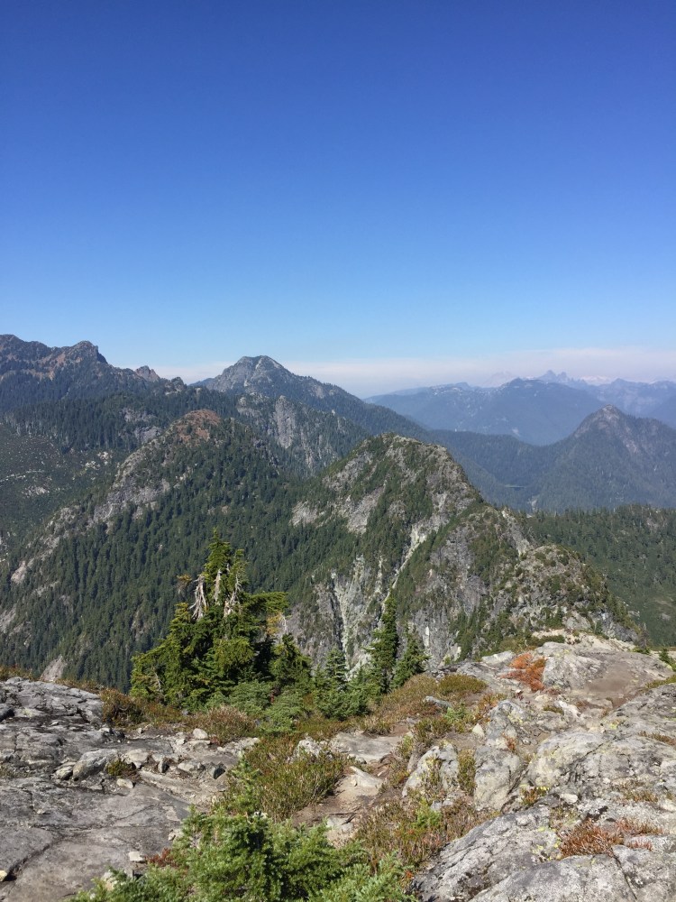
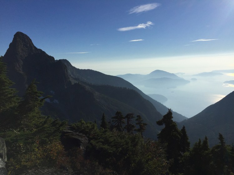
Even though we weren’t camping where we had planned to, our spot was one of the best I have ever camped at. We had the peak plateau all to ourselves and the peak offered views of Howe Sound, Vancouver, the Lions, and the Coast Mountains all around us. It was spectacular.
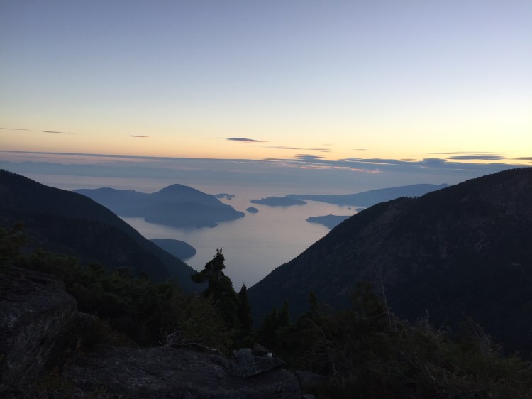
7:42pm (Sunset)
As the sun finally set on our long day, I was tired, but the beauty of what lay before us took all feelings of stress away. The sunset view alone made the day’s work well worth it. We settled in for an early bed time with the plan to get up at the crack of dawn to get to a reliable water source as soon as possible. As the sky began to darken, I fell asleep quickly.
September 7th, 2018
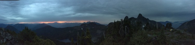
6:15am (Wakeup)
Wake up call was just before sunrise. The weather had a moody feeling and as the day began the rain started to drizzle down. On the horizon was suddenly a brilliant orange. The colours from the rising of the sun made the mountains in the distance look as though they were erupting in grand style. We decided to eat and pack quickly so we could get to what was originally supposed to be our camping spot for the night, Magnesia Meadows, within two hours as we needed a good water source.
6:52am (The Start – Day 2)
Wet, but excited to be on the go, we shouldered our packs and started moving with a new found pace that only a good night’s sleep could provide. We made our way down the slippery rocks and roots and then quickly started climbing again up David Peak.
7:30am (David Peak) ~15km
We promptly gained the summit and enjoyed the views as the rain had stopped and the sun had now fully risen. The route down from David Peak proved tricky as it was steep and full of loose dirt that is be treacherous when a little wet. Nevertheless, we made it to the bottom with little fuss.
The next section was a steady and quick climb up to Magnesia Meadows. We had done it! We had finally reached what was supposed to be our camping spot for the previous night and we had finally reached our first real water source of the trip.
8:29am (Magnesia Meadows) ~16.5km
As we hastily filtered water and ate a bit more food, I could feel the energy level rapidly increase as we began to forget the panic of the day before and look forward to the trail ahead. We had finished most of the climbing and we were ready to power through the rest of our journey. With full water bottles and quenched thirsts we put on our packs and headed out from Magnesia Meadows.
8:54am (Departing Magnesia Meadows)
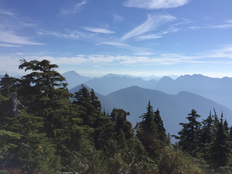
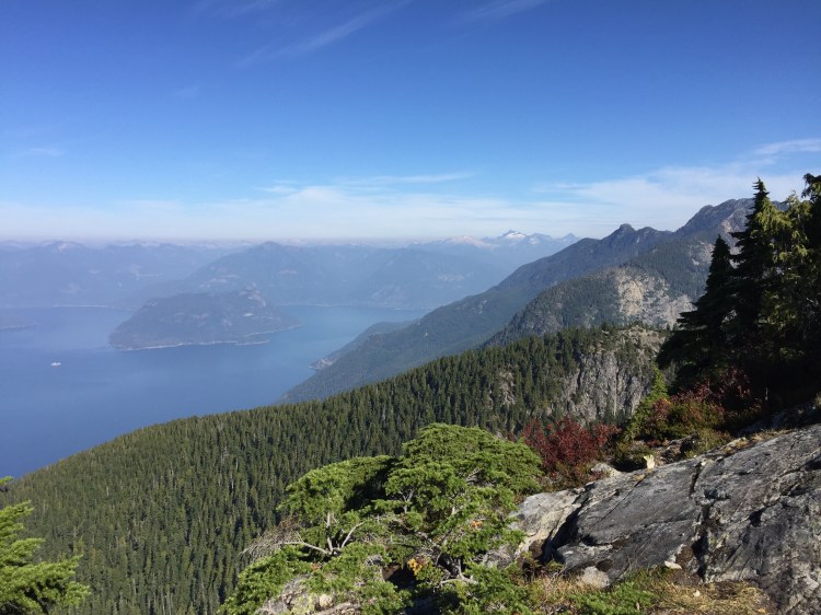
The next section was a relaxed traverse along the south side of Brunswick Mountain. The trail was quiet, calm, and much easier than the parts we had covered the previous day. The occasional great view would pop up and remind us of the beauty of this area and how lucky we were to be out there.
9:57am (Hat Pass) ~20km
Right before 10am we reached Hat Pass. Just after Hat Pass, the slope of the trail starts to trend downwards and past this point, the rest of the way is almost completely downhill. I started to make my way down the steep trail towards Brunswick Lake. I could hear my Dad behind me with the clicking of his trekking poles ringing out in the mountains.
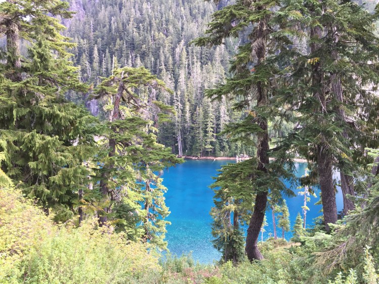
10:36am (Brunswick Lake) ~21km
As we approached Brunswick Lake the bright blue waters started to appear through the trees. Realizing that we were at a beautiful lake surrounded by many peaks, we decided to take a break and have an early lunch. I pulled out my stove and prepared some lunch. Relaxing by Brunswick Lake was just so nice that we couldn’t help but spend over half an hour eating and taking in the sights and sounds all around us.
11:15am (Leaving Brunswick Lake)
A little after eleven we were once again out on the trail. With full bellies and renewed energy, the hiking felt easier than it had at any point in the past 24 hours.
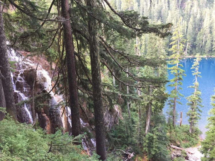
11:30am (Hanover Falls and Lake) ~22km
As we continued on we passed some under-appreciated and really beautiful spots the trail has to offer. Hanover Falls roared beside the trail and Hanover Lake loomed in front of us as we made our way down. Almost five hours into our day of hiking and we still had not seen a single person. I truly had a feeling of being immersed in the wilderness even though I was less than 30km away from Downtown Vancouver.
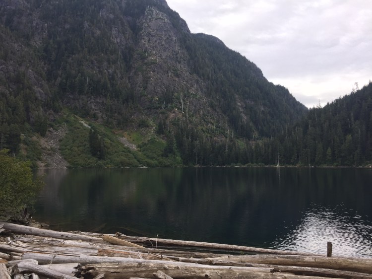
12:29pm (Deeks Lake) ~24.25km
A little after noon we reached Deeks Lake, one of the last milestones on the trail. The path around the lake is very nice, but at this point we had been walking with heavy packs for such a long period of time over the past two days, that our feet were beginning to feel it. Regardless, we couldn’t help but take in the beauty around us – there was no other place I would have rather been at that moment.
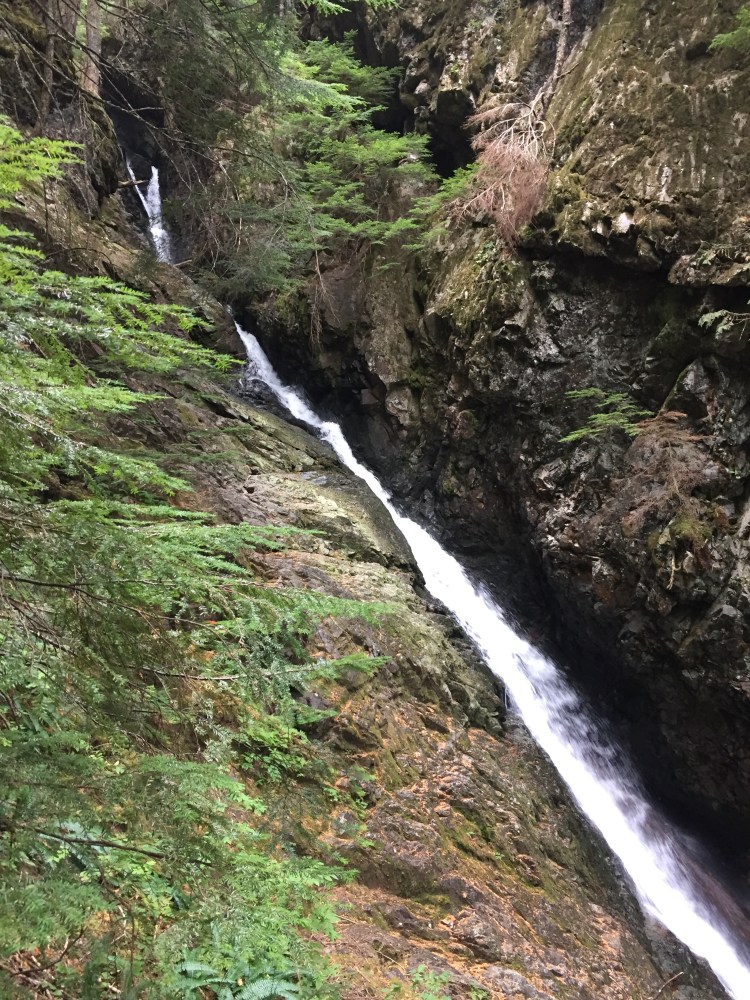
12:51pm (Phi Alpha Falls and the Downhill Slog) ~25km
Past Deeks Lake, Phi Alpha Falls rumbled in the woods. The trail began to steepen as we were making the final descent down to the end of our journey at Porteau Cove. My Dad brought out the trekking poles as he carefully picked his way down the trail. I decided to take a different approach and instead began to run down sections of the downhill slog. I found this both easier on my feet, and pretty fun too. I would not recommend this technique though, as a fall coming down that slope would not be fun.
3:00pm (The End) ~31.5km
As the grade of the trail lessened, we approached the last section of our hike – the ever-exciting logging road! As our feet hit gravel, I felt a bit of relief that we had made it through all the difficult parts of the trail, but also a tinge of disappointment that it was over.
A few quick kilometres later and we reached the pavement of the parking lot. I took a look around and noticed a bulletin board on the side of the lot. On the board was a map of the trail. As my eyes passed over the sections of the trail that we had traversed over the past 31.5 hours, I thought about how just 24 hours earlier, I was thinking we might have to be airlifted out of there due to dehydration and exhaustion! It was a good reminder that you always need to go into nature ready and prepared for anything so you don’t put your own life, and the life of potential rescuers, at risk.
The Howe Sound Crest Trail was a trail packed with amazing sights, adventures, and difficulties. And, honestly, it was a blast.
